May 29, 2017

British Hieroglyphics | England

This morning I went to Tolworth Postcard Fair and I had some amazing finds! The most intriguing postcard of them is the one below:


I cannot quite make the writing, but on top left it's written: 'HIEROGLYPHICS found at Pompei. "E.E."'. Then there is a smaller postcard of Windermere glued on. On the right there is more writing [which I cannot easily read] and some sketches of what it seems like a daily calendar.


In the back the address is written with some beautiful calligraphy. It was posted on 24 July 1901 from Ambleside and a half penny stamp commemorating Queen Victoria's Jubilee was used.

Geranium "Gustav Emich"


I don't prefer postcards with flowers on them, but this is part of my collections and I have to admit the colours are quite nice. It depicts Geranium "Gustav Emich", Latin name Pelargonium hortorum, Family Geraniaceae. One of the varieties used for summer bedding. The South African Pelargonium zonale, from which modern "Geranium" were evolved, was brought to England in 1710, but it is rarely seen now.

May 28, 2017

Connemara ponies | Ireland


This postcard shows two Connemara ponies (Irish: Capaillín Chonamara), a pony breed originating in Ireland. They are known for their athleticism, versatility and good disposition. The breed makes excellent show ponies. The largest display of the finest Connemara ponies in the world takes place at the Clifden Show, Connemara, Ireland, on the third Thursday in August every year.


It was posted on 25 September 1974 from Bideford, Devon, England. It reads: 'The weather so far very mild & we have only managed a few walks along the sand & front. It's nice to have a change od scene though. It's very quiet here. We hope Helen will [...] some warmer still weather with her. We hope you had a safe trip yesterday. I will enjoy some hint of nostalgia in the autumn. Bert's engine is certainly an attraction & the tender will be an added interest. Hope all is well. Love [...]'

Marloes | Wales


This worn postcard shows Marloes Sands,  an approx. 1.5 kilometres (0.93 mi) long remote sandy beach in Pembrokeshire, Wales, near the village of Marloes. The name Marloes appears to derive from Old Welsh mail "bare" and ros "moor" or "promontory", identical to Melrose in Scotland. It is locally pronounced "Marlows". A part of Little England beyond Wales, it has been essentially English-speaking for 900 years. It's broadly curved and surrounded by cliffs. Walking on the beach gives great views of Skokholm Island and Gateholm Island.

The beach is located SW from the Marloes village and there is a National Trust car-park nearby (charge per day or free for National Trust members). There is a track that leads from the main road to the beach. There is a disused World War II Royal Air Force airfield RAF Dale, above the south east cliffs of the beach. There are approximately three accesses to the beach which become very useful if you get caught by the tide coming in. Besides the main access from Runwayskiln there is also an access to the north, near Gateholm Island, that requires some scrambling over the rocks and another access to the south that has steps leading to the midsection of the beach.

Mouth of the River Daron | Wales


This postcard show picturesque Aberdaron, a community and former fishing village at the western tip of the Llŷn Peninsula (Welsh: Penrhyn Llŷn) in the Welsh county of Gwynedd. It lies 14.8 miles (23.8 km) west of Pwllheli and 33.5 miles (53.9 km) south west of Caernarfon, and has a population of 965. It is sometimes referred to as the "Land's End of Wales", or in Welsh Pendraw'r Byd (roughly "far end of the world"). The community includes Bardsey Island (Welsh: Ynys Enlli), the coastal area around Porthor, and the villages of Anelog, Llanfaelrhys, Penycaerau, Rhoshirwaun, Rhydlios, Uwchmynydd and Y Rhiw.

Y Rhiw and Llanfaelrhys have long been linked by sharing rectors and by their close proximity, but were originally ecclesiastical parishes in themselves. The parish of Bodferin/Bodverin was assimilated in the 19th century. The village was the last rest stop for pilgrims heading to Bardsey Island (Ynys Enlli), the legendary "island of 20,000 saints". In the 18th and 19th centuries it developed as a shipbuilding centre and port. The mining and quarrying industries became major employers, and limestone, lead, jasper and manganese ("Mango") were exported. There are the ruins of an old pier running out to sea at Porth Simdde, which is the local name for the west end of Aberdaron Beach. After the Second World War the mining industry collapsed, and Aberdaron gradually developed into a holiday resort.

May 27, 2017

Glentanner Station | New Zealand


This is a postcard of Glentanner Station, Mountain Cook, Canterbury, Nea Zealand. Glentanner Station is 45,000 acres and carries 9,000 Merino sheep and 230 Red deer. The run was taken up in 1858 by the Dark brothers and extended from Boundary Stream in the south and included the Mount Cook National Park in the north. Two lake raising's and the Department of Conservation grazing policy have meant that Glentanner now runs from Whales Stream in the south to the Mount Cook National Park boundary in the north. Glentanner Station has been run by the Ivey family since 1957. Today, three generations are living on the property.

Cognac et Pineau | France


This postacrd is from France and it has a Cognac and Pineau theme. Cognac is a variety of brandy named after the town of Cognac, France. It is produced in the surrounding wine-growing region in the Departements of Charente and Charente-Maritime.

Cognac production falls under French Appellation d'origine contrôlée designation, with production methods and naming required to meet certain legal requirements. Among the specified grapes Ugni blanc, known locally as Saint-Emilion, is most widely used. The brandy must be twice distilled in copper pot stills and aged at least two years in French oak barrels from Limousin or Tronçais. Cognac matures in the same way as whiskies and wine barrel age, and most cognacs spend considerably longer "on the wood" than the minimum legal requirement.

House of Savoy | Italy


This is one of the most interesting postcards I own. It depicts the Savoy Coat of Arms. The House of Savoy (Italian: Casa Savoia) is one of the oldest royal families in the world, being founded in 1003 in the historical Savoy region. Through gradual expansion, it grew from ruling a small county in that region to the attainment of the rank of king (of Sicily) in 1713. Through its junior branch, the House of Savoy-Carignano, it led the unification of Italy in 1861 and ruled the Kingdom of Italy from 1861 until 1946 and, briefly, the Kingdom of Spain in the 19th century. The Savoyard kings of Italy were Victor Emmanuel II, Umberto I, Victor Emmanuel III, and Umberto II. The last monarch ruled for a few weeks before being deposed following the Constitutional Referendum of 1946, after which the Italian Republic was proclaimed.

Founder's Day Parade on 29 May 1911 | England


This colourful postcard shows the Founder's Day Parade on 29 May 1911. The Founder's Day Parade is held on the 29th May, the birthday of King Charles II, the founder of the Royal Hospital in Chelsea. The statue of King Charles II is covered with oak leaves to commemorate the fact that King Charles hid in an oak at Boscobel, after the Battle of Worcester.

The Royal Hospital in Chelsea is a hostel or guest house for worthy veterans of the Army, who are prevented by old age, or disabilities contracted in the field, from earning a livelihood. Designed and built under the supervision of Wren.


The card is a Tuck's Postcard and it was posted on 31 July 1936. The stamp used shows King Charles II and has a value of one penny. 1d red was in use from January 1st 1912 - 1934. The card reads: 'many thanks for card. Hope my native air is doing you good. If it goes on raining much more we shall be living at Catersham-on-the-sea! C. seems quite happy as Lady of the House in your absence. Love from self& daughter. A. Robins'

Ilfracombe | England

This morning we want for a nice walk at Guildford, where I stumbled upon I cute vintage shop. There I found some very interesting old postcards.


The first one shows Ilfracombe, a seaside resort and civil parish on the North Devon coast, England, with a small harbour surrounded by cliffs. The parish stretches along the coast from the 'Coastguard Cottages' in Hele Bay toward the east and 4 miles along the Torrs to Lee Bay toward the west. The resort is hilly and the highest point within the parish boundary is at 'Hore Down Gate', 2 miles inland and 860 feet (270 m) above sea level.

The landmark of Hillsborough Hill dominates the harbour and is the site of an Iron Age fortified settlement. In the built environment, the architectural-award-winning Landmark Theatre is either loved or hated for its unusual double-conical design. The 13th century parish church, Trinity, and the St Nicholas's Chapel (a lighthouse) on Lantern Hill, have been joined by the Damien Hirst owned statue, Verity, as points of interest. [wikipedia]

May 20, 2017

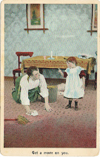
Bamforth & Co Ltd postcards #2


These are two more funny postcards from Bamforth & Co Ltd. They are both unused.


Sifnos | Greece


This postcard is Sifnos (Greek: Σίφνος; the spelling Siphnos is obsolete in English but still by convention often used to refer to the island in ancient times), which is an island municipality in the Cyclades island group in Greece. The main town, near the center, known as Apollonia (pop. 869), is home of the island's folklore museum and library. The town's name is thought to come from an ancient temple of Apollo on the site of the church of Panayia Yeraniofora. The second-largest town is Artemonas (800), thought to be named after an ancient temple of Apollo's sister-goddess Artemis, located at the site of the church of Panayia Kokhi. The village of Kastro (118), was the capital of the island during ancient times until 1836. It is built on top of a high cliff on the island's east shore and today has extensive medieval remains and is the location of the island's archeological museum. The port settlement, on the west coast of the island is known as Kamares (245).

There are 360 churches in the island of Sifnos, more than any other island in Cyclades. It is no coincidence, the large number of festivals held on the island almost every month. Many churches and monasteries of the island are historical sites with great religious and architectural interest. The most important one is the monastery of Panagia Chryssopigi. One of the most "popular" churches of the island, is one of the Seven Martyrs, where many couples choose to get married. Still, Panagia Poulati renowned both for its beauty and what the landscape that surrounds it.

It was posted from Sifnos, but I cannot make out the date.

Malibu Spice


Even though I don't generally like art or ad postcards, I like the simplicity and bright colour of this one. I think it is an ad postcard for Malibu Spice.

Rumcajs, Manka and Cipísek | Czech Republic

As I have written in a previous post, a while a a large number of old postcards came to my possession. Among them there are a lot with Czechoslovakian stamps [so I guess the cards were sent between 1918 and  1993] and most of the cards depict Czechoslovakian cartoons like Krtek [the Mole]. All the cards are written in Czech [which I don't speak] so it takes a lot of research to find out the name and origin of each cartoon character. If you know Czech and you can translate the writtings for me please let me know!

The following postcards depict Rumcajs, Manka and Cipísek. Rumcajs is the main character of the Czechoslovak bedtime cartoon from 1967. He is one of the most famous robbers of all times. Before he became an outlaw he was an ordinary shoemaker and the owner of the shop in a small town called Jicin. And if chance did not so ordain he would lead a quiet life sewing and repairing shoes. Unfortunately, he offended the local governor, calling his sizable feet elephant-like. That unflattering comment has become a cause for Rumcajs exile to the Rzacholecki forest and made him change his appearance and profession. From a quiet cobbler Rumcajs turned into a robber wearing a distinctive red hat, with a thick black beard and a revolver loaded with acorns. 

Despite his threatening appearance, Rumcajs was a robber of gentle nature, willing to help the residents of Jicin. He also stood up for forest animals frequently harassed by His Majesty the Prince, his capricious wife and servants. The robber always overcame all adversities because Rumcajs and his family - his wife Manka and his son Cypisek were favorable not just for animals, but also for magical characters like Rusalka (the water-nymph), Aquarians and Giants living in the neighborhood. 

The author of the origin of Rumcajs was Vaclav Čtvrtek who described the adventures of the robber in eight volumes of his book. In Poland, translations of four books from the series of the popular robber adventures were published. The animated series O loupežníku Rumcajsovi was directed by Ladislav Čapek and the project of the characters was created by a well-known painter Radek Pilař. In Poland, the first part of the 39 episode bedtime cartoon O rozbójniku Rumcajsie was broadcast on 3 July 1970 and it was narrated by Boguslaw Sochnacki. In 1974 the musical The Adventures of Rumcajs the Robber with music by Katarzyna Gaertner and libretto by Ernest Bryll, was first shown at the Polish Theater in Warsaw. The play enjoys a remarkable success and is still very popular.[source]


The bearded guy in the red hat is Rumcajs who as a bandit, constantly fighting with an unnamed degenerated aristocrat.

The Lone Star State | USA


This postcard is again from my collection. It is a multi-view of Texas, USA. Texas (Spanish: Texas or Tejas) is the second largest state in the United States of America by both area and population. Geographically located in the South Central region of the country, Texas shares borders with the U.S. states of Louisiana to the east, Arkansas to the northeast, Oklahoma to the north, New Mexico to the west, and the Mexican states of Chihuahua, Coahuila, Nuevo León, and Tamaulipas to the southwest, while the Gulf of Mexico is to the southeast.

Houston is the most populous city in Texas and the fourth largest in the U.S.A.. Texas is nicknamed "The Lone Star State" to signify its former status as an independent republic, and as a reminder of the state's struggle for independence from Mexico. The origin of Texas's name is from the word "Tejas," which means "friends" in the Caddo language.

Nazaré and Vila Real de Santo António | Portugal

Last night we went to a Portuguese restaurant, so today I browsed through my collection and found these two postcards from Portugal.

This postcards shows washerwomen of petticoats at Nazaré, Portugal. Nazaré is a town and a municipality in subregion Oeste and Leiria District, in Portugal. It is one of the most popular seaside resorts in the Silver Coast/Costa de Prata, Portugal. The population in 2011 was 15,158, in an area of 82.43 km². The municipal holiday is September 8 with the Festas da Nazaré a religious and profane festival with processions, bullfights, fireworks, folk dancing and a fair. The town consists of three neighbourhoods: Praia (along the beach), Sítio (an old village, on top of a cliff) and Pederneira (another old village, on a hilltop). Praia and Sítio are linked by the Nazaré Funicular, a funicular railway. [wikipedia]

May 15, 2017

Dome of the Rock and Shrine of the Báb | Israel

These two postcards are from my own collection. The first one shows the Dome of the Rock in Jerousalem and the second one shows Shrine of the Báb in Haifa as seen from Mountain Carmel. 


The Dome of the Rock (Arabic: قبة الصخرة‎‎ Qubbat al-Sakhrah, Hebrew: כיפת הסלע‎‎ Kippat ha-Sela) is an Islamic shrine located on the Temple Mount in the Old City of Jerusalem. It was initially completed in 691 CE at the order of Umayyad Caliph Abd al-Malik during the Second Fitna, built on the site of the Roman temple of Jupiter Capitolinus, which had in turn been built on the site of Herod's Temple, destroyed during the Roman Siege of Jerusalem in 70 CE. The original dome collapsed in 1015 and was rebuilt in 1022–23. The Dome of the Rock is in its core one of the oldest extant works of Islamic architecture.

Its architecture and mosaics were patterned after nearby Byzantine churches and palaces, although its outside appearance has been significantly changed in the Ottoman period and again in the modern period, notably with the addition of the gold-plated roof, in 1959–61 and again in 1993. The octagonal plan of the structure may also have been influenced by the Byzantine Church of the Seat of Mary (also known as Kathisma in Greek and al-Qadismu in Arabic) built between 451 and 458 on the road between Jerusalem and Bethlehem.

Nafplio | Greece

My parents visited Nafplio recently, one of the most picturesque Greek towns, and sent me these two beautiful postcards.


Nafplio (Modern Greek: Ναύπλιο) is a seaport town in the Peloponnese in Greece that has expanded up the hillsides near the north end of the Argolic Gulf. The town was an important seaport held under a succession of royal houses in the Middle Ages as part of the lordship of Argos and Nauplia, held initially by the de la Roche following the Fourth Crusade before coming under the Republic of Venice and, lastly, the Ottoman Empire. The town was the capital of the First Hellenic Republic and of the Kingdom of Greece, from the start of the Greek Revolution in 1821 until 1834. Nafplio is now the capital of the regional unit of Argolis.


The water castle of Bourtzi (Greek: Μπούρτζι, from Ottoman Turkish برج - burc meaning "tower"; formerly Καστέλι, Kasteli) is located in the middle of the harbour of Nafplio. The Venetians completed its fortification in 1473 to protect the city from pirates and invaders from the sea. The Greeks regained it from the Turks on June 18, 1822, from where they assisted in the siege of Nafplio. Until 1865 it served as a fortress. It was then transformed into residence of the executioners of convicts from the castle of Palamidi. From 1930 to 1970, it served as a hotel. Since then, it is mainly a tourist attraction hosting occasionally parts of the Summer Music Festival. [wikipedia]

May 13, 2017

1940s Relive | England

Today we went to the Brooklands Museum for the '1940s Relive'. Quite a spectacular experience. It felt as if we really traveled back in time! Of course I couldn't resist and buy a couple of postcards.


I truly love this postcard - even though it is just a reprint. It shows Doreen Evans and Kay Petre with an MG in the  Brooklands Paddock, 1930s [copyright Brooklands Museum]. American-born driver Kay Petre, she was born Kathleen Coad Defries in 1903 and moved to England with her husband Henry Petre in 1930. Kay took an interest in motor racing after being at events held at Brooklands, a circuit that also had an airfield where her husband would often fly. Henry bought Kay her first car for her birthday – a Wolseley Hornet Daytona Special that she landed on the podium in her first two races. By 1933 she was ready for something more and upgraded to a far more capable 2 litre Bugatti.

Doreen Evans was one of the leading female racing drivers of the 1930s and she came from a family of dedicated racers who owned the Bellevue Garage in Wandsworth. She was also one of “The Dancing Daughters” to race for MG at Le Mans in 1935. [source]


The British Racing Drivers' Club (or BRDC) is a membership body which represents the interests of professional racing drivers from the United Kingdom. The club was founded in April 1928 by Dr. J. Dudley Benjafield, one of an informal group of British racing drivers known as the "Bentley Boys". The BRDC began primarily as a socialising club for Benjafield and his fellow drivers.

May 12, 2017

Quisqueyanos | Dominican Republic


This postcard is from Dominican Republic. The Dominican Republic (Spanish: República Dominicana) is a sovereign state occupying the eastern five-eighths of the island of Hispaniola, in the Greater Antilles archipelago in the Caribbean region. The western three-eighths of the island is occupied by the nation of Haiti, making Hispaniola one of two Caribbean islands, along with Saint Martin, that are shared by two countries. The Dominican Republic is the second-largest Caribbean nation by area (after Cuba) at 48,445 square kilometers (18,705 sq mi), and 3rd by population with approximately 10 million people, of which approximately three million live in the metropolitan area of Santo Domingo, the capital city.

For most of its history (up until independence), the country was known as Santo Domingo — the name of its present capital and patron saint, Saint Dominic—and continued to be commonly known as such in English until the early 20th century. The residents were called Dominicanos (Dominicans), which is the adjective form of "Domingo," and the revolutionaries named their newly independent country La República Dominicana.

In the national anthem of the Dominican Republic (Himno Nacional) the term "Dominican" never appears. The author of its lyrics, Emilio Prud' Homme, consistently uses the poetic term Quisqueyanos, that is, "Quisqueyans." The word "Quisqueya" derives from a native tongue of the Taino Indians and means, "Mother of all Lands." It is often used in songs as another name for the country. The name of the country is often shortened to "the D.R."

Norrbotten | Sweden


This atmospheric postcard shows fog over a lavender field in North Bothnia in Sweden. You've got to love the colours!

Norrbotten, known in English as North Bothnia, is a Swedish province (landskap) in northernmost Sweden. It borders south to Västerbotten, west to Swedish Lapland, and east to Finland. During the Middle Ages, Norrbotten was considered to be terra nullius ("no man's land"). The area was sparsely populated by Sami, Kvens and different tribes/people related to the Finns. From the Middle Ages on, the Swedish kings tried hard to colonise and Christianise the area. This took time, however; even today, there are Finnish and Sami minorities living in the area, who have maintained their own culture and customs. Not being one of the old historical provinces of Sweden, Norrbotten had not been granted a coat of arms in the same way as the others. As recently as 1995, after decades of controversy, Norrbotten got its arms, thus recognized as a "real" province.


The postcard was posted on 26 October 1992.

May 8, 2017

Wales Millennium Centre | Wales


A couple of weeks ago, I visited the beautiful city of Cardiff and also went to Cardiff Bay. There I was really impressed by the Wales Millenium Centre (which you can see pictured on the above postcard).

Wales Millennium Centre (Welsh: Canolfan Mileniwm Cymru) is an arts centre located in the Cardiff Bay. The site covers a total area of 4.7 acres (1.9 ha). Phase 1 of the building was opened during the weekend of the 26–28 November 2004 and phase 2 opened on 22 January 2009 with an inaugural concert. The centre has hosted performances of Opera, ballet, Dance, Theater, comedy and Musicals.

The Centre comprises one large theatre and two smaller halls with shops, bars and restaurants. It houses the national orchestra and opera, dance, theatre and literature companies, a total of eight arts organisations in residence. It is also home to the Cardiff Bay Visitor Centre. The main theatre, the Donald Gordon Theatre, has 1,897 seats, the BBC Hoddinott Hall 350 and the Weston Studio Theatre 250. In 2001 Lord Rowe-Beddoe was appointed chairman of Wales Millennium Centre, a company limited by guarantee. Board members include Sir Michael Checkland. [wikipedia]

May 7, 2017

Burford | England


One of my favorite destinations in the UK is the Cotswolds. A few months ago I spent the weekend in Burford, one of the most picturesque English towns I have even visited.

Burford is a medieval town on the River Windrush in the Cotswold hills in West Oxfordshire, England. It is often referred to as the 'gateway' to the Cotswolds. The toponym derives from the Old English words burh meaning fortified town or hilltown and ford, the crossing of a river. The 2011 Census recorded the population of Burford parish as 1,410 and Burford Ward as 1,847.

Burford has twice had a bell-foundry: one run by the Neale family in the 17th century and the other run by the Bond family in the 19th and 20th centuries. Henry Neale was a bell-founder between 1627 and 1641 and also had a foundry at Somerford Keynes in Gloucestershire. Edward Neale had joined him as a bell-founder at Burford by 1635 and continued the business until 1685. Numerous Neale bells remain in use, including at St Britius, Brize Norton, St Mary's, Buscot, St James the Great, Fulbrook and SS Peter and Paul, Steeple Aston. A few Neale bells that are no longer rung are displayed in Burford parish church. 

Tilos | Greece


A couple of months ago, when I came home from work I had a pleasant surprise! A beloved friend has moved to Tilos island and sent me this beautiful postcard! She wrote that this is the view she has on her way to work (she teaches Greek to refugee children).

Tílos (Greek: Τήλος; ancient form: Telos) is a small Greek island and municipality located in the Aegean Sea. It is part of the Dodecanese group of islands, and lies midway between Kos and Rhodes. It has a population of 780 inhabitants (2011 census). Along with the uninhabited offshore islets of Antitilos and Gaidaros, it forms the Municipality of Tilos, which has a total land area of 64.525 square kilometres (24.913 sq mi). Tilos is part of the Rhodes regional unit.

Popularly, Telos was the son of Helios and Halia, the sister of the Telchines. He came to the island in search of herbs to heal his ill mother, and later returned to found a temple to Apollo and Neptune. However, Telos (Telo or Tilo) does not appear in Greek mythology and the name probably has an unknown pre-Hellenic origin. Pliny the Elder notes that in antiquity Telos was known as Agathussa (Αγαθούσσα) (also Agathusa and Agathousa). In the Middle Ages, it was known by the Italian as Episcopio, either because it was a Bishop Seat or because its position as Vantage Point. The island has also been called in Turkish İlyaki and in modern Italian Piscopi.


It was posted on 15 March 2017 and the stamp used pictures Aristotle. To mark the 2400th anniversary of the birth Aristotle, who was born in 384 BCE, Hellenic Post issued a commemorative set of stamps to honour his invaluable contribution to humanity. The works of the great Macedonian philosopher of antiquity, the student of Plato and the tutor of Alexander the Great, unique in range and influence in the history of human thought, are an integral and essential part of world cultural heritage.

This is the thinking behind UNESCO proclaiming 2016 “Aristotle Anniversary Year”, an initiative of the Interdisciplinary Centre for Aristotle Studies at the University of Thessaloniki, implemented by the Greek National Commission for UNESCO.